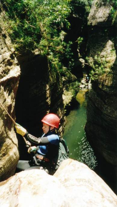
Nicole on the abseil. The chains are up on the left rock face.
|
|
Fortress Canyon
Fortress is a nice beginners canyon with relatively easy access. Kind of a
cross between the creek walking of Du-Faur's, and the nice small abseil and
pools of Dalpura.
Enter via Mt Hay Rd which heads north of Leua. The road in would be barely passable
in a 2 wheel drive, 4WD is recommended, especially after rain.
Park at the turn off and start the long walk along the fire trail. Near the
end of the fire trail where it swings away to the right, there is a track that
branches off straight ahead, ensure you take this track.
The entire round trip is a good 10km, so there is a lot of walking. Most of
it is relatively flat so it's not too difficult.
When you are almost at the highest point of the ridge there is distinct track
that heads off to the right down into the valley. Follow this track all the
way into the canyon. The track disappears in places, just keep heading straight
and it reforms. We took the first branch off to the right down into the creek.
You can choose to enter here or keep walking along the track and join later.
There is a nice little canyon section near the start, but then it degenerates
into scrubby creek walking for the next hour or so. There is a track that follows
the creek almost all the way. Choose to bash it out in the creek, or take the
easier track option. You won't be missing much. You eventually come to some
tricky drops that can be a bit hairy. Investigate various options and choose
the safest way down.
Just when you start to think this is a poor excuse for a canyon you come to
the canyon proper with an exciting compulsary 2m jump-in. It's deep so there
is little problem. Lots of nice constricted swims follow including one very
narrow section about 2ft wide. This is one of the highlights. You soon reach
the abseil. It's about 8m or so, and is done from chains high up on the rock
to the left. The start is a bit tricky, but just swing out a bit and you'll
be fine. You drop into the water, just be sure to avoid the rock jutting out
at the bottom. Some people jump this abseil, but the water is less than 2m deep.
Not recommended.
You soon reach the end of the canyon where you can stop for lunch at the top
of the big waterfall.
Follow the obvious track out on the left up the gully. It's steep, and seems
to get steeper and never ending, but you eventually reach the top which has
awesome views. Follow the track and fortress ridge back to the car.
Allow a good 8 hours for the whole trip car to car.
Here is the Garmin Mapsource GPS Log file for the complete trip!

Nicole on the abseil. The chains are up on the left rock face.