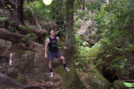
The tree for the first abseil.
|
|
Trip Report - Four Dope Canyon, 27th Dec 03
We started out at 9:30am
from the new Hole In The Wall barrier, two in the group had done HITW before,
but apart from that the area was new to us and would be an exploratory trip.
We chose Four Dope because Jamieson lists it as a 1 day trip, better than some
of the other "long day" trips. We realised the irony of 4 people heading
into Four Dope canyon!
There was another large group at the carpark that were heading into Arch canyon,
the exit track we planed on taking.
The walk along the fire
trails to the "972" hill was easy and uneventful, this took about
1.5hrs. At this point the tracks seems to disappear, but a small track did go
off south. Jamieson then says to navigate E and then NE, then SE, so we ignored
the track heading South. We headed into the scrub following the ridge East and
then headed North East after a few hundred meters. We followed the path of least
resistance in the scrub, which wasn't all that bad, fairly easy going. We started
to trend South. There were wombat tracks everywhere, but no good tracks that
we could find. After a while we saw a canyon forming in front of us heading
South, a quick check with the GPS said it was Arch canyon. We had to head North
and then East again to get around it, luckily there was a fairly easy bridge
that took us around. A while and much light scrub bashing later we encounted
another canyon in front of us, and the GPS once again confirmed that it must
be Four Dope. We had the 528015 Jamieson cocords programmed into the GPS as
the "start" of the canyon proper, and the GPS said it was still 800m
away, directly South.
We thought this was close enough to drop into the creek, but we decided to stay
out on the ridge as long as we could and find a nicer place to drop in. After
all, 800m was a fairly long creek bash, and the canyon still looked very wide
and scrubby at this point.
After about 400m the canyon closed in more and we were forced to drop in right
beside the creek. The creek was scrubby and we tried our best to stay out to
one side. With about 200m to go to the coord I dropped down into the creek as
a pass up the left side seemed tricky. Bad idea, cutting grass was everywhere.
The others had actually found an easy pass over the ridge, but I continued on
as I was so far in. The cutting grass lived up to it's name, I was cut the shreds.
Should always bring those long pants on a new canyon...
The worst of the scrub was now over with 100m to go to the co-ord, which we
knew would be a very rough estimate. But sure enough, when the GPS said we had
10m to go, the canyon started to form proper. A Jameison co-ord which was spot
on!
We were all thinking that no canyon could make up for the 2km scrub and bashing
which we put up with on the walk in, so we were not hopeful. Everyone had cuts
and scratches at the very least. The canyon certainly did not seem promising,
it was canyon like but very scrubby.
Out of the blue we saw the first slings around an obvious tree on the left.
We were amazed when we looked over the edge, very Claustral like! Finally, after
all that work we were going to be rewarded, at least in this little bit. What
was to follow?
After some lunch and suiting up, we dropped the 20m into the slot, one of the
best slot abseils we have done. A spectacular overhanging drop in front of a
waterfall. With some more water and a big swing you might be able to make it
into the waterfall. This abseil alone made the trip worthwhile.
A short while later we came to the second drop. We looked at the obvious trees
on the left for some slings, but could not find any. It did not look like anyone
had gone down the left side. A drop down the middle V slot behind a fern did
not look promising either. We found a log placed down a slot on the right, and
this proved to be the easy way down with the help of a handline and sliding
down the log. This is supposed to be Jamiesons second abseil, but it never eventuated.
The third drop was a fairly ordinary 8m drop into a smaller but nice slot from
a ledge on the right hand side. There is a sling around an obvious tree.
The forth drop (10m maybe) is from old logs placed across the canyon, as described
in Jamieson. This seemed fairly safe. The slings were back tied to another log
with cheap manilla rope as a backup.
A final down climb into a lovely clear pool was the last obstacle. Some logs
on the bottom allowed us to do a deep wade instead of a swim, the first really
wet bit of the whole canyon.
A final nice canyon section leads into the Bungleboori.
We headeed upstream on the bungleboori which is a nice trip in itself, and has some really amazing natural features. There is only one short wade, with the rest of the trip being shallow creek walking. The entire trip can be done without getting your head wet, and on a hot day could probably be done without wetsuits.
About 50min later we hit Arch canyon on the right. It didn't seem very impressive judging from the last short drop. It looked scrubby in the slot, with hardly any water.
A climb around a tree on
the immediate left leads you up the steep cliff line. There looked to be a few
ways up and we choose the path of least resistance. It seems that many people
have taken different paths up this exit.
We got to a big cliff and decided to try up the middle. One of us made it to
the top with some tricky exposed climbing, but the rest of us decided to try
a pass around the left side of the cliff. This lead to another gully with again
three ways up. We choose the middle path again and it proved a bit scrubby but
ok. A handline was needed in several spots on the way up the ridge.
We met up again at the top and basically just followed a bearing to the "972"
hill, taking the scrub path of least resistance. One of us kept low while the
rest of us headed toward the top of the ridge earlier, and we found a solid
track. We figured this must be the track which Jamieson shows goes right through
to Cannons canyon. Our GPS log showed that we followed parallel to this track
on the way in, about 100m North - ARGH! all that scrub and there was a track
there all the time.
The track headed back to the "972" hill and actually joined the main track which we though had run out. It in fact joins about 10m South of the main clearing, and a bit more searching would have revealed this, it was fairly obvious.
It rained on the way out, and we got back to the cars around 6:30pm.
All up it was a long but very enjoyable exploratory trip, with some good navigation and route finding tests thrown in. The upper part of the canyon is quite horrid, and it's best to drop into the cayon as close to the Jamieson coords as possible. There certainly seemed to be plenty of ways in. The canyon had a very virgin feel to it, with virtually non of the moss disturbed, or other signs of having been visited. Definitely a canyon worth doing at least once. Even scrub bashing most of the way, it was fairly easy but slow going. It took us over 9 hours, but we wasted many hours by getting off track and having to navigate and route find. I think it would only take us 6 or 7 hours next time at most.

The tree for the first abseil.
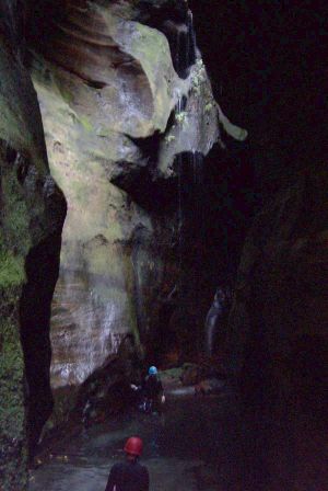
The bottom of the first drop - lovely!
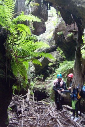
After the first drop.
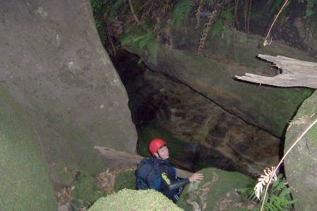
The second drop, supposed to be an abseil, but it's a fairly simple slide down
the log.
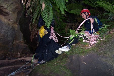
The last abseil from logs across the canyon. Note the backup rope holding the
logs in place.
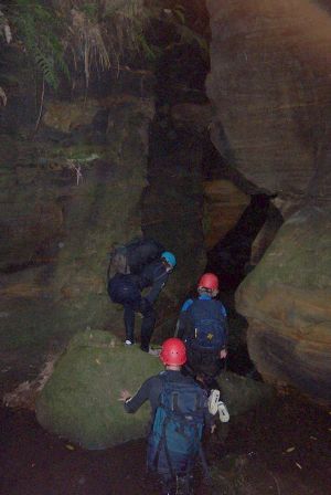
Contemplating the last little drop into a crystal clear pool. If there weren't
logs in there you could jump it.
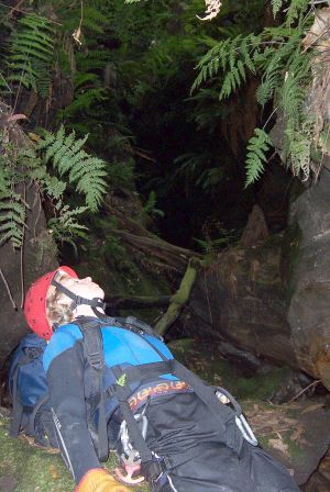
Canyons are a great place to relax...
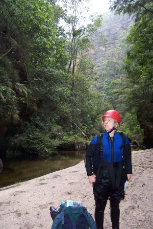
In the Bungleborie South branch.